Smart Trip Map, the free Google Maps Fishing App
-
All of your data on Smart Trip Map is secure and absolutely private.
-
All of your data on Smart Trip Map is secure and absolutely private.
-
All of your data on Smart Trip Map is secure and absolutely private.
-
All of your data on Smart Trip Map is secure and absolutely private.
-
All of your data on Smart Trip Map is secure and absolutely private.
-
All of your data on Smart Trip Map is secure and absolutely private.
Smart Trip Map is one web application for the avid fisherman. We have made it available absolutely free since 2008 without the usual annoying ads and popups, and without spamming our users or sharing and selling their information. This app was built by an avid fly fisherman for himself, and then provided to the rest of the community with no strings attached.
Getting USGS or USBR Streamflow Gages, NOAA Tide Charts, National Weather Service (NWS) Weather Forecasts and Conditions, and much more, has never been easier thanks to this free, full-featured Google maps fishing app.
All of the features of Smart Trip Map are free. This Google maps fishing app was made for fishermen, by fishermen. It is completely secure, and absolutely private, as it was built on the premise that you'd never want to find someone standing on your favorite rock.
Launch Smart Trip MapAll of your data on Smart Trip Map is secure and absolutely private.
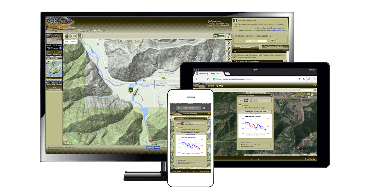
Streamflow Gages
Smart Trip Map makes accessing USGS and USBR streamflow gages easier than ever, and it's free! The Google maps fishing app will find the nearest streamflow gage to your currently selected location. Every single USGS and USBR gage is available everywhere in the U.S. and U.S. Territories. You can even choose to view all the nearby streamflow gages, taking your online exploring to the next level. Just drop a marker, or use the GPS feature, and get streamflows. It's that easy!
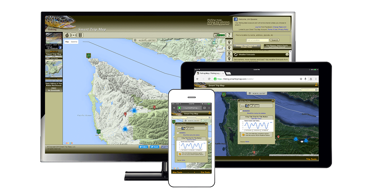
Learn more » Launch Smart Trip MapTide Charts
NOAA tide charts are more accessible than ever, and it won't cost you a thing! The Google maps fishing app will find the nearest tide station or tide substation to you currently selected location. Every tide station and tide substation in the U.S. and U.S. Territories is available to you. Set the date as far back in time or as far forward into the future as you like. You can even choose to view all the nearby NOAA tide stations and substations, taking your online exploring to the next level. Just drop a marker, or use the GPS feature, and get tide charts. It couldn't be simpler.
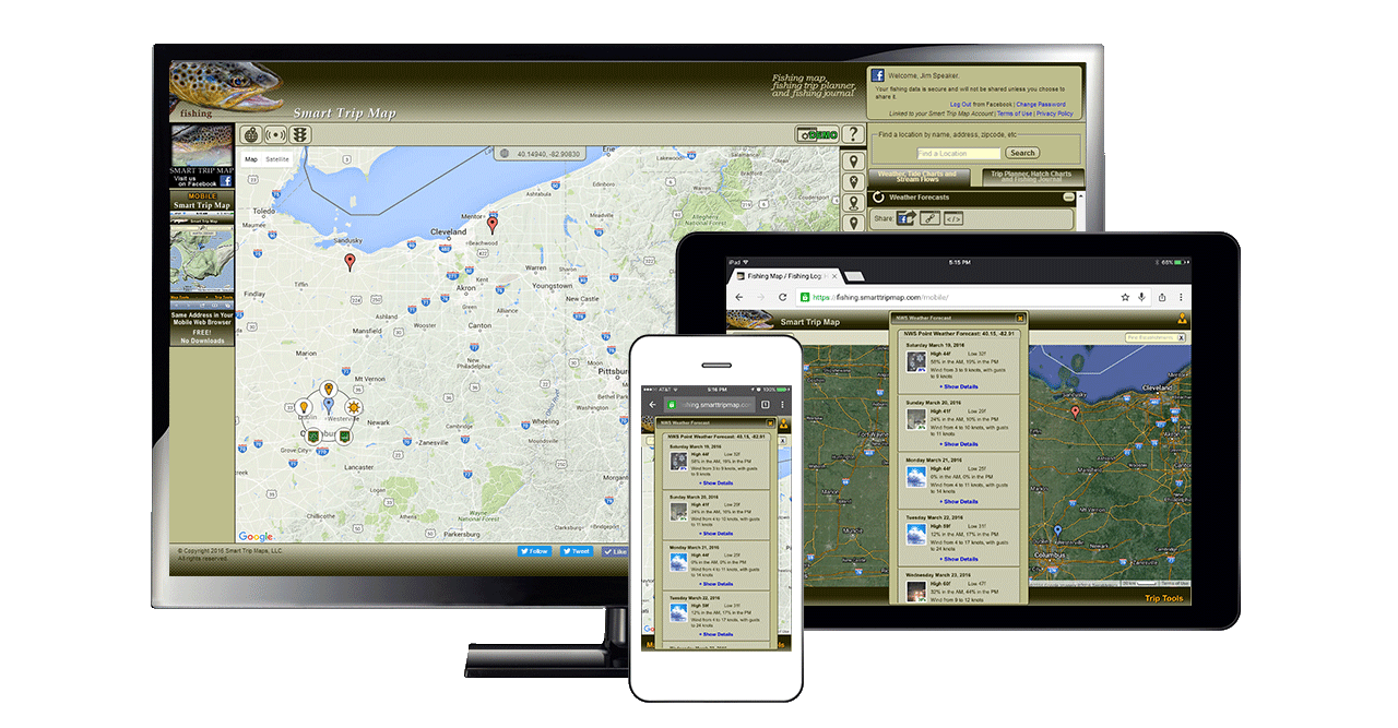
Learn more » Launch Smart Trip MapWeather Forecasts
National Weather Service (NWS) spot forecasts just got easy — at absolutely no cost! The Google maps fishing app will get a 7-day detailed weather forecast for your currently selected location. No more putting up with weather forecasts for locations that are somewhat near the location where you'll be fishing. NWS spot forecasts are for the exact location. Just drop a marker, or use the GPS feature, and get weather forecasts and conditions. One click — no hassles!
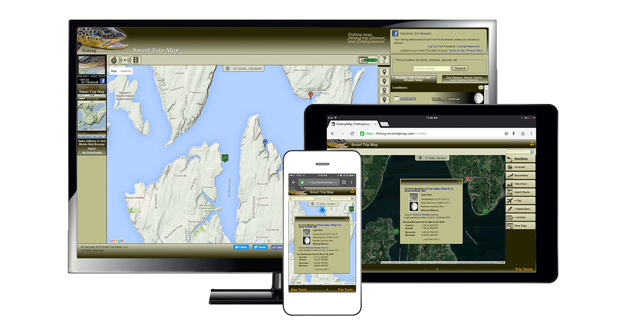
Learn more » Launch Smart Trip MapConditions, Solar and Lunar Info
Whenever you select a location by clicking a marker or using the GPS feature, Smart Trip Map will get the current weather conditions, and calculate the moon phase, sunrise, sunset, moonrise and moonset times. You can simply select another date as far into the past or as far into the future as you like to see what the sunrise, sunset, moonrise, moonset, and moon phase was or will be.
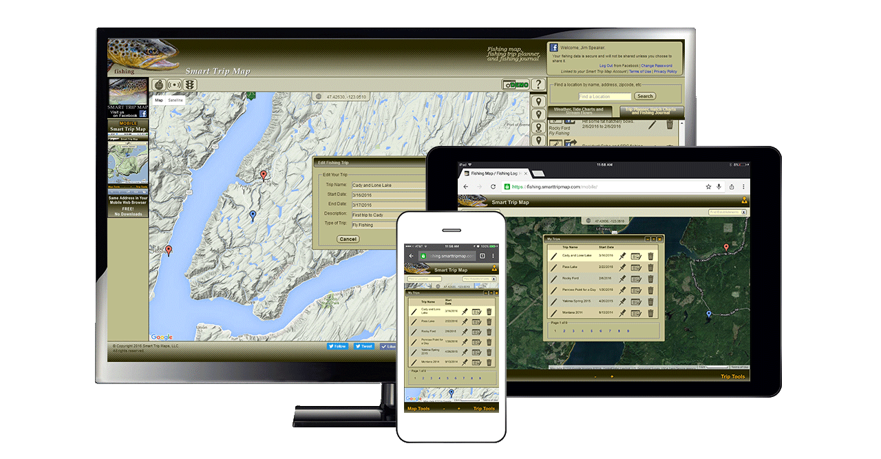
Learn more » Launch Smart Trip MapTrip Planner
The Trip Planner is what ties it all together. You can easily find locations and establishments, and create trips, setting one or more waypoints for your adventure. Complete driving directions are just a click away. You can revisit past trips and jump from location to location quickly and easily, making future trip planning as well as scouting streamflows, tides and weather a breeze.
Learn more » Launch Smart Trip MapFishing Journal
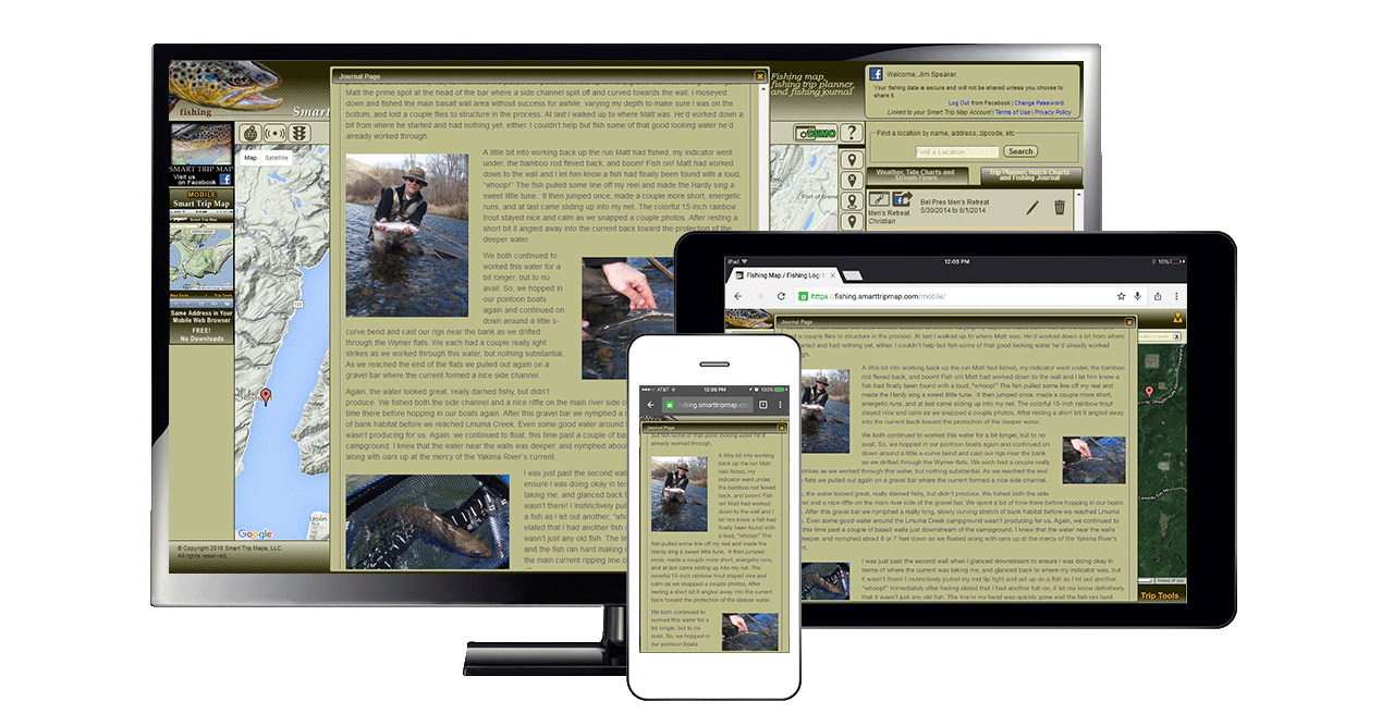
Smart Trip Map allows you to easily chronicle your adventures with beautiful, photo-laden Fishing Journal entries associated with your trips. Your fishing journal is completely private and allows you to share specific journal entries on social media, your blog, or your favorite forums only if you choose to do so.
Learn more » Launch Smart Trip Map